NYC Subway Map Redesignd
- Started
- Last post
- 23 Responses
- ********0
No. Much worse.
- nb i like that you can see the express more clearlybklyndroobeki
- It looks nicer but I'm not sure I like not seeing land masses.CyBrainX
- duckseason0
Found Central Park.
- lolzinstrmntl
- hahabklyndroobeki
- hahahahahasureshot
- hahahahahahahaCyBrainX
- ********3
I worked on LA metro and WMATA, hawaii, It's not easy doing cartography. In my personal opinion I think it looks alot better.. The best one is the Weekender map (Vignelli)
its anyone is in Honolulu, Hawaii someone go to the airpoint and snap a shot the map in there, send it to me for my portfolio. all i got is a stupid print.


- ********0
It might look better, but it's far less useful than the current one.
I don't need to hang a subway map on my wall, I need to it help me navigate the city.
- how is it far less useful than the current one.********
- Yeah. How is it worse?monospaced
- It doesn't show the stations in relation the streets.monNom
- Doesn't need to. You'd know that if you've ever ridden the subway in NYC.monospaced
- how is it far less useful than the current one.
- robotron3k1
what about this design, it kinda looks familiar...

- ED?utopian
- -1********
- Pen IslandiCanHazQBN
- upvote because penismekk
- ha ha********
- ********0
"how is it far less useful than the current one."
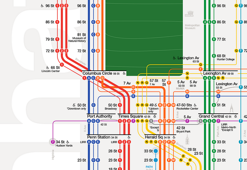
This map is missing the rivers, the smaller parks, and most landmarks. Think about how often you meet someone at a park or they say, "Meet me at this coffee shop, it's just north of Madison Square Park" or whatever. Unless I've already memorized the location of every park in the city, I need Google or a second map to find them.
Same problem with leaving off the neighbourhood names. In NYC there aren't super strict borders on neighbourhoods, but if someone says, yeah, we're down in Chelsea... if you don't know where that is, you now need Google or a second map.
And it's missing rivers/bridges? Again, these things are helpful on a map because it helps people orient themselves and learn the city, so that over time they won't need to rely so heavily on the map.
Do you think it looks cleaner? That's because it's missing tons of useful information.
- i don't think you're correct here. It's not a map of nyc, it's a subway map. as a subway map it serves it's purpose in a much more efficient wayGnash
- as a transit user, I need to find the route from A to B, I'm not deciding what landmarks to hit while i'm in the subway looking at a map.Gnash
- I see what you're getting at but I think you are asking too much from a transit map.it has one jobGnash
- +1 gnash********
- And I would image that a good number of the transit users aren't in town long enough to learn the city over timeGnash
- In the case of the NYC map, it may be just a subway map, but it is the only NYC map I have ever needed.********
- Removing useful information does not make my daily life easier.********
- you better hang on to your map, then :)Gnash
- I agree gnash. It doesn't need more than the subway lines and having multiple really helps find the express vs local routes. It's better.monospaced
- Make your plans before you enter the woods.bklyndroobeki
- nb... I thought you were out of Edmonton, Alberta. Not NY.ETM
- +1 Gnash********
- I'm currently spending half my time in each city. Might be in NYC full time in 2016, if I can find work. ANYONE HIRING?!?!********
- nb, now your comments make sense :) i think you're talking with native/long time NY'ers here. we love this new map.bklyndroobeki
- I hear you. If you already know the city, then this new map would do nicely. But the purpose of a map is to help people who don't know the city.********
- I agree that the current map might need a better method of showing express routes in Manhattan. But, otherwise, it's actually really great.********
- doesnotexist0
at a glance it looks like confusion
- ********2
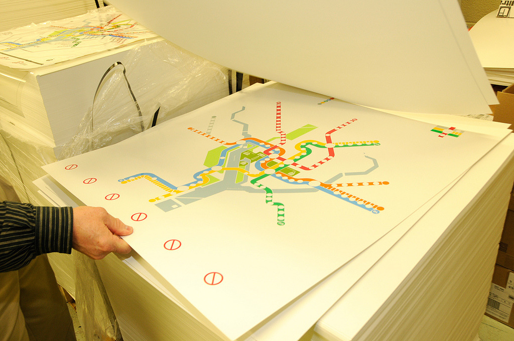
If you follow cartography over the years they have become more minimal/simplified. Transit systems across the U.S. have been continually pushing towards the perfected 45 degree angle "spider maps" originally made by Harry Beck and George Dow.
Stations have moved from putting key landmarks on maps to making other wayfinding signage seen throughout stations that apply to the surrounding areas.
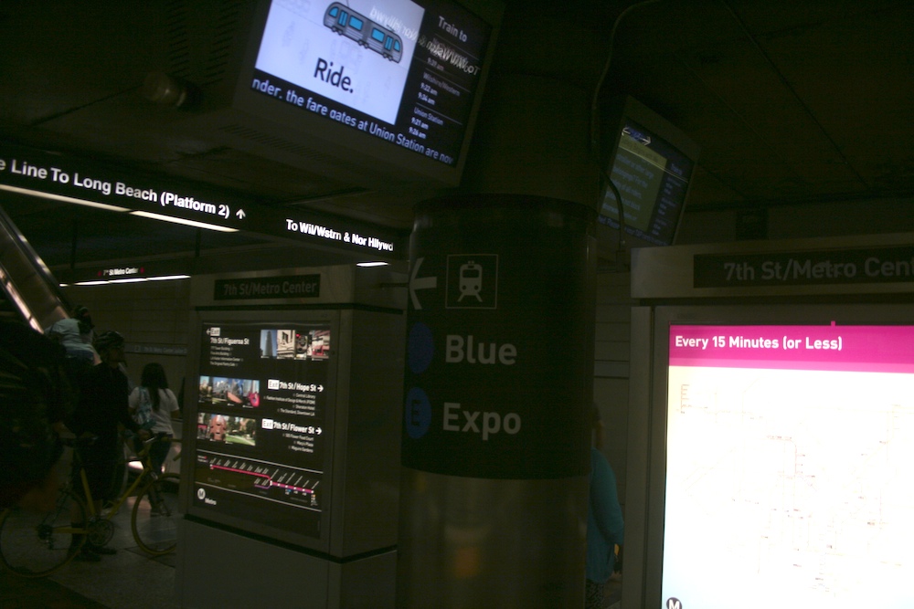

(my work ^ simplified spider requested by local transit)maps are going to continue to get more simplified. transit systems like WMATA who originally agreed with nb's way of thinking will continue to look like a clusterfuck
old WMATA:

New:
- hey, nice map, PGnash
- So, once I find the station I need (from somewhere else) then I use the transit map, then I hope the information I need is located at the station.********
- And if I went to the wrong station? Well, better dig out some other city map and start over.********
- every station has a master map aka "regional map" so when you get off course you refer to a map that covers every line and usually a few well known landmarks.********
- Yeah, all I'm asking for is landmarks!********
- panel maps will never show street names or landmarks, so if ur on the street ur a bit fucked unless you get some info pamphlets usually supplied on busses********
- Yes. When you get to the stop you look at your phone again like a sane person and don't expect entire city street maps posted everywhere.monospaced
- I'm not expecting entire city maps. Just a few parks outlined and some rivers, and neighbourhood names.********
- I'm not criticizing your map, by the way. I'm not familiar with that transit system, so I can't comment.********
- wear gloves while kiosking. those things are nasty.yurimon
- ********0
here is old WMATA

- sarahfailin1
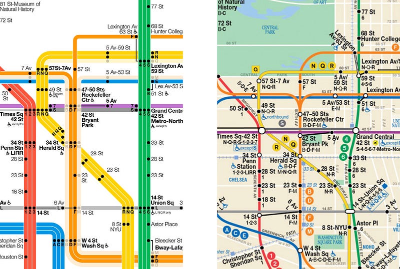
I like that you can see what the transfers are.- admittedly the old one has more of a flow... it's accurate. ie., the F doesn't make a sharp turn like that through Central Park, LOLbklyndroobeki
- are you from ny? because F goes under central park on right turn like NQR which also turn sharp and also goes under central park.2002
- all i'm saying is that this is more accurate but i understand why they did it that way http://imgur.com/e5X…bklyndroobeki
- you are right, it doesnt make that hard of a turn but I think NQR does hard turn2002
- people looking at the map don;t care how accurate the turns are. The new one is much cleaner.dbloc
- pr22
The redesign might look pretty but is utterly useless. I live din the city for 17 years and still use them current map to orient myself (between which avenues a stop is for example).
- i_monk1
Transit maps are not city maps or the Yellow Pages. You don't use a transit map to find out where "that coffee shop across from the park a block northwest of Blah Station" is.
And if you really don't know where you're going, look it up on Google Maps or whatever first.
- you use a transit map to get to that coffee shop. leaving out streets and avenues isn't helpful.dirtydesign
- dirtydesign0
nb is right.
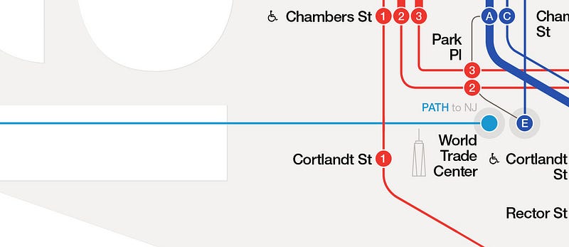
that map blows. doesn't show streets avenues or anything else useful. showing subway stops only not helpful.- if this one is real, ignore...
http://i.imgur.com/X…dirtydesign - Considering every stop IS a street name of have to disagree.monospaced
- if this one is real, ignore...
- sureshot2
I thought this was about the sandwiches.
- 20021
purpose of subway map is locate the closest subway station near the destination - without street or other references, this map is pointless.
- 20021
designer didnt start with a use case -
'I need to go to E 26rd street and 2nd ave, what is the closest subway station?'
- pango-1
You can buy one!
http://standardsmanual.com/
- bklyndroobeki1
Kind of jealous...
"A graphic designer just got his unauthorised redesign adopted as the official Luxembourg bus map"
http://www.citymetric.com/transp…